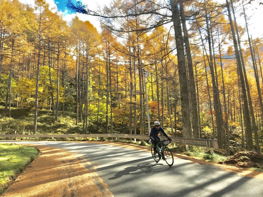
Guide to Cycling Shirabiso Pass しらびそ峠 1,914m | Japan’s Southern Alps Panoramic Highest Road

Introduction
The second tallest mountain in Japan, Mt Kita (3,193m), lies just 50km northwest of Mt Fuji. Here, in the Minami Alps National Park (tr. South Alps), is some of Japan’s most untouched alpine nature. And, thanks to the amazing rural road building of Japan, cycling the Shirabiso Pass can take you up to over 1,900m above sea to spectacular views of the Minami Alps!
Gain
5/5
Views
5/5
Accessibility
2/5
Pavement
4/5
Zen Factor
4/5
Climb Score Card from our full article on the 14 Best Cycling Climbs in Japan (Hint, Not Mt Fuji!).

Osusume ~ Recommended Route Cycling Shirabiso Pass
One of the things that makes the Shirabiso Pass much more illusive than many of the other high passes in Japan is the sheer difficulty of getting to it. While you can approach the pass most easily from Iida City in Nagano, those looking to make the most of the ride will be rewarded with well over 100km of beautiful mountain roads and the wild Tenryu River with our recommended route.
From Chino City in southern Nagano the route is quite straight forward just tracing the Rt 152 south. Then, following signs up to Shirabiso Pass しらびそ峠. Once atop, I highly recommend taking the twisting switchbacks through the famous Shimoguri no Sato 下栗の里 terraced rice fields. Finally, after the long descent, hop on the old road tracing the mighty Tenryu River 天竜川 to Iida City (tr. Heavenly Dragon River).
An epic one day at over 155km and over 4,000m elevation gain. For those looking to break the ride up into two days a stop at Ooshika Town’s Salt Onsen Ryokans is a great midway point.

Shirabiso Pass しらびそ峠 Strava Route File

Scorecard Breakdown
[Climb Score Card from our full article on the 14 Best Cycling Climbs in Japan (Hint, Not Mt Fuji!).]
Gain – 5/5 | 1,300m from the north & 1,500m from the south
Views – 5/5 | Sweeping views of the South Alps, rugged untouched wilderness, and beautiful roads.
Accessibility – 2/5 | 2hr express from Shinjuku Station to Chino Station, 4hr direct bus from Iida Station to Shinjuku Station
Pavement – 4/5 | Overall good condition pavement thanks to low traffic area.
Zen Factor – 4/5 | Though narrow roads from the north side there is minimal traffic. Once on the Southside of the pass traffic picks up as that is the main side for busses & motorists.
More Rides & Reads
- Ashikaga, Tochigi (8)
- Bicycle Logistics in Japan (5)
- Bike Rental (3)
- Bikepacking Japan Routes (4)
- Cycling River Paths of Japan (5)
- Day Trips Rides from Tokyo (17)
- Famous Bike Routes in Japan (7)
- Food (5)
- Getting to Your Tour (4)
- Gifu Prefecture (1)
- Gunma Prefecture (20)
- Hakuba, Nagano (2)
- Hiking (4)
- Ibaraki Prefecture (1)
- Ikaho Onsen Town (4)
- Ise City, Mie (1)
- Ishikawa Prefecture (2)
- Japan Online (5)
- Japanese (2)
- Japanese Culture (8)
- Kagoshima Prefecture (1)
- Kanagawa Prefecture (1)
- Kanazawa City (2)
- Kansai Region (1)
- Kanto Area Rides (16)
- Kanto Region (20)
- Kii Peninsula (1)
- Kiryu City, Gunma (14)
- Kita Kanto Area Rides (18)
- Kita Kanto Region (25)
- Kumano Kodo (1)
- Kyoto (3)
- Kyushu (1)
- Lake Biwa (2)
- Maebashi City (1)
- Matsumoto City, Nagano (6)
- Mie Prefecture (1)
- Minami Alps National Park (2)
- Mount Fuji (4)
- Mount Haruna (4)
- Mountain Biking Japan (1)
- Nagano Prefecture (11)
- Nara Prefecture (1)
- Nikko National Park, Tochigi (9)
- Nikko, Tochigi (9)
- Noto Peninsula (2)
- Onsen Hot Springs (2)
- Ryokan Hotels (7)
- Saitama Prefecture (1)
- Self Guided Cycling Routes in Japan (5)
- Seto Naikai (Inland Sea) Region (3)
- Shibukawa, Gunma (1)
- Shiga Prefecture (1)
- Shimanami Kaido (4)
- Shizuoka Prefecture (5)
- Snow Season in Japan (Ski & Snowboard) (1)
- Takasaki City, Gunma (4)
- Tochigi Prefecture (14)
- Tokyo Area Rides (11)
- Toyama City (2)
- Toyama Prefecture (2)
- Travel in Japan (15)
- Uncategorized (8)
- Utsunomiya, Tochigi (1)
- Wakayama 800 (1)
- Wakayama Prefecture (1)
- Yamanashi Prefecture (5)
I have Trek 520; with front and rear panniers for bike touring. So Japanese rail and bus lines allow bicycles on board?
You need a rinko bag to get on rail. Busses can be tricky https://biketourjapan.com/rinko-bags-and-traveling-with-your-bicycle-on-trains-in-japan/